Alpine Route
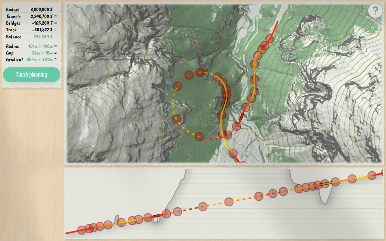
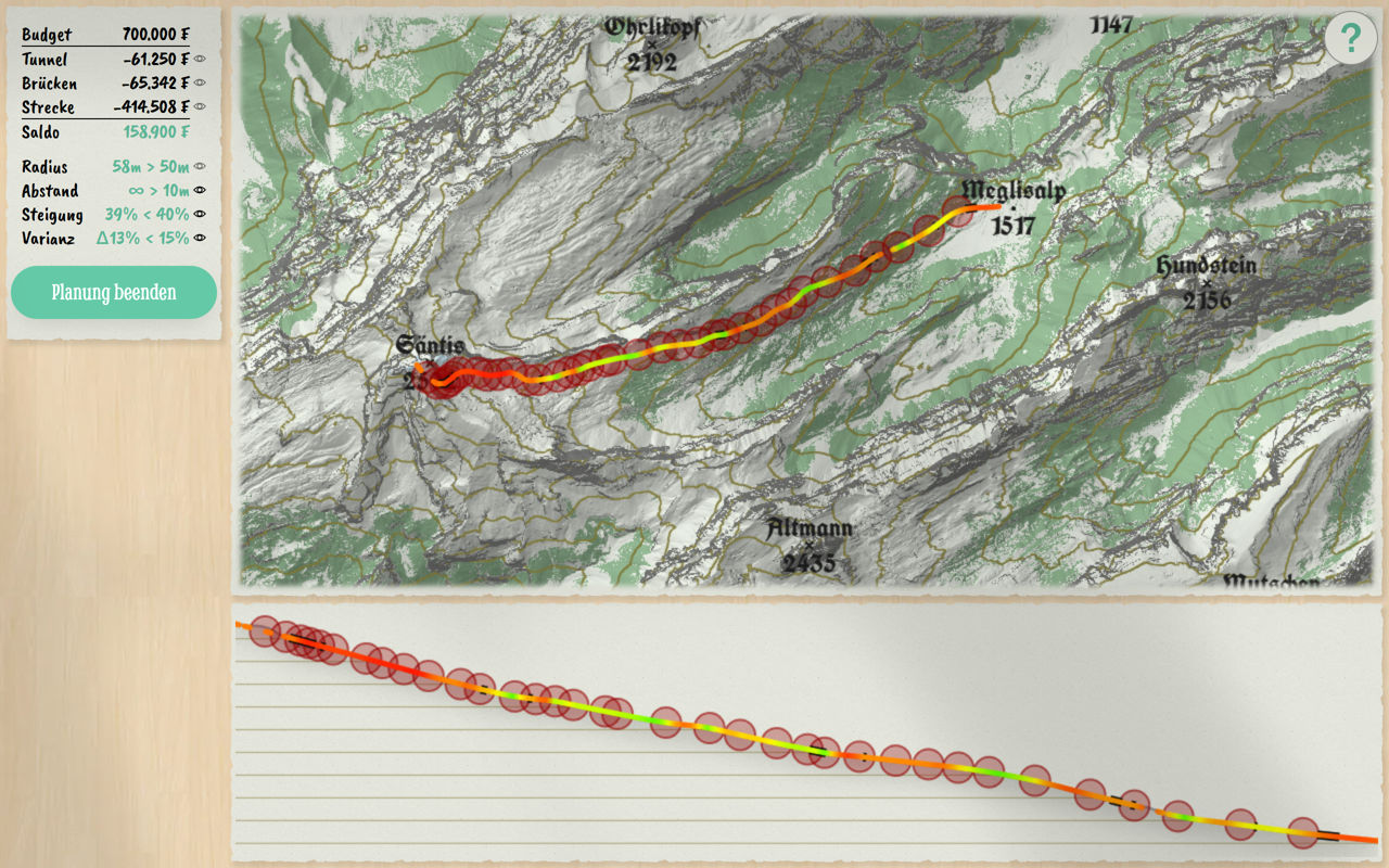
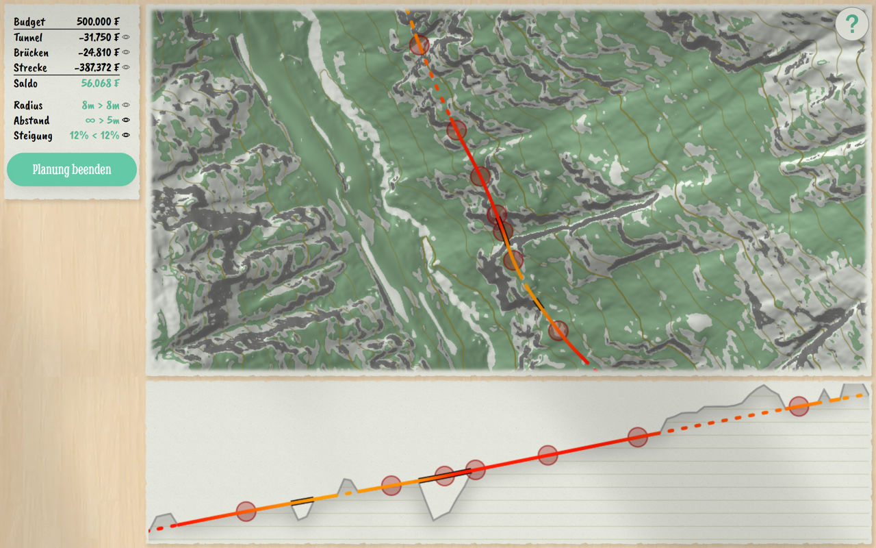
In Alpine Route, you take on the role of a route planner at the end of the 19th century. Your task is to design the optimal paths for roads and railways through challenging alpine terrain. Detailed maps of real landscapes with precise elevation data are at your disposal as tools.
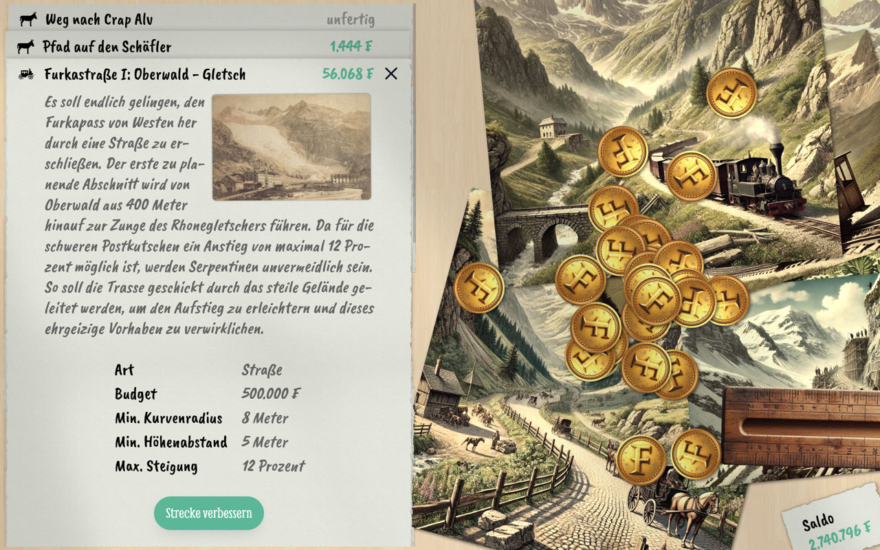
Throughout your career, you will plan a variety of transport routes: from mule tracks and roads to narrow-gauge railways, cog railways, and funiculars. Each type of transport infrastructure presents unique challenges, with strict requirements for maximum gradients and minimum curve radii. To meet these demands, you will need to incorporate intricate switchbacks, tunnels, and spectacular bridges into your designs.
The scenarios are inspired by both real-world routes, such as the famous Albula Railway, and visionary projects that were never realized, like a railway to Mount Säntis.
Also available on

Comments
Log in with itch.io to leave a comment.
Great game! Love to see more like this, maybe one where you have to plan a river.
Happy you liked it. :)
Good idea regarding rivers, I thought about a game about planning dams.
What game are you working on now if any?
Neat idea but I found it pretty hard to determine height with the map.
Thanks for your feedback. I raised the contrast of the map shading a bit now. I hope it's now easier to see the heights of the map.